Collector
Digital terrain maps created in Kyrgyzstan for accurate disaster forecasting | Collector
Digital terrain maps created in Kyrgyzstan for accurate disaster forecasting
ИА 24

Digital terrain maps created in Kyrgyzstan for accurate disaster forecasting

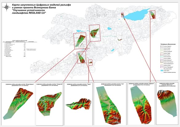
As part of KG RESILAND project, the Ministry of Emergency Situations of Kyrgyzstan received digital terrain models for 14 priority areas, covering a total of around 6,000 hectares with a resolution of up to 3 meters.

Go to News Site